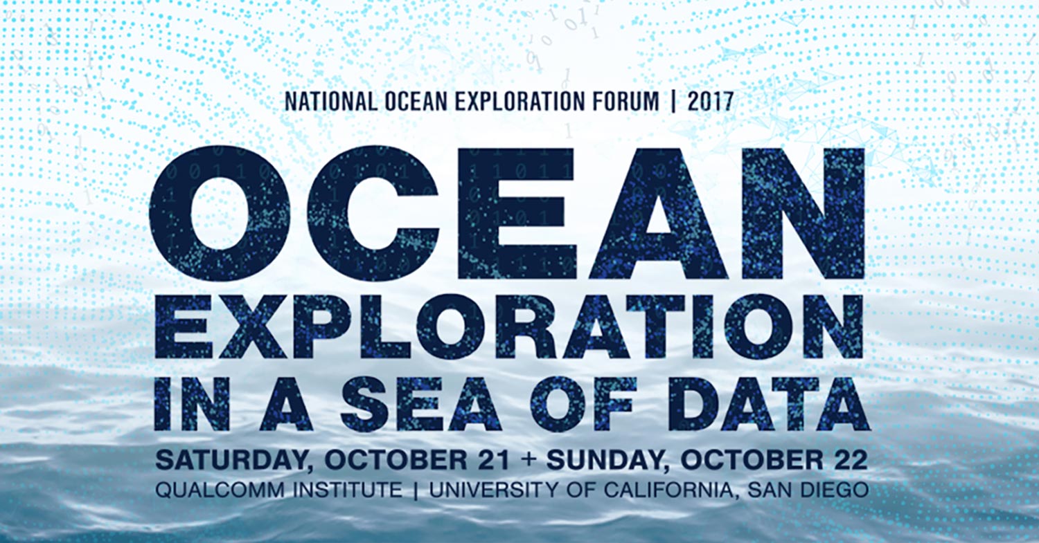
Oceanic Exploration in a Sea of Data
San Diego, California. In the quest to better understand the data science analysis and visualization techniques that we are utilizing in our MIA work, Project Recover sent three members from BentProp to The University California San Diego and the National Oceanic and Atmospheric Administration’s Oceanic Exploration in a Sea of Data Forum, at the Qualcomm Institute this October 20 and 21st.
The forum attracted some of the top U.S. scientists in many oceanic disciplines. The focus on increasing data collection opened the doors to new opportunities, new challenges, and a growing sense of urgency.
Beyond the MIA
The hunt for MIA plane wrecks is difficult with many challenges from research, logistics, and luck. Finding what was once a plane wreck requires precision and luck. This simple core activity of searching the ocean floor increasingly attracts developing technology for mapping earth’s oceans and a growing symbiotic relationship between the searchers and scientists. This automation and scanning vastly improve the probability of finding new wrecks and MIAs.
The Science Side
This forum was a great opportunity to see the other half’s side of our missions. Some of the top US scientists from all disciplines of oceanic science came together under one roof to share leading-edge projects, concepts, and processes with a focus on the ever increasing consumption and collection of data.
This was an amazing experience and a focused look into the current state of oceanic science in all forms from biology to robotics. The turnout was intimate, with under 100 attending and made it easy to meet, converse and absorb new information.
Advancing Technology
Exponential advancements in technology and computing power are allowing scientists to go farther, deeper, and record more of the experience than ever before. From scanning 2000 feet of a glacier to the earth’s surface to video monitoring heat vents 5000 feet below the ocean’s surface and almost 500 miles offshore, scientists are learning more and faster than ever.
This boom is a blessing and a curse. The data generate opportunities across entire fields, creating new careers and challenges around data management and storage needs to levels never seen.
New Ways to Interpret
Science is generally based on testing against a hypothesis. Generating so many data points allows scientists to sometimes just to get the data and see what it reveals. This one aspect is a game changer.
New Ways to Engage
The sheer volume of data is creating a gap between the data and consumption. The gap is being filled by creatives who are pushing the boundaries of Virtual Reality, 3D modeling, mapping and the collection of the data itself.
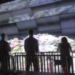
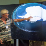
In one demo we experienced the 2011 Tōhoku earthquake and tsunami via spatial orientation and 3D sound creating an entirely different experience of engagement with the data and providing new discoveries and hypotheses.
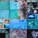
In another demo, scuba divers descend miles deep into caves and coral reefs and record data so rich archeologists and scientists from multiple fields can visually map out space to the millimeter. Virtual and 3D spaces can be mapped out with such detail and accuracy archeologists and bioscientists can virtually explore, engage, and understand finds and life without ever visiting.
As one scientist said, “We are now able to stand in our data.”
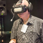
Bring on the Holodeck
Alice Winters from Nasa’s Mission to Mars program is a spatial creative. The data streaming down from Mars is ever increasing and rich with data points. At present their labs bring these data points together in a virtual reality where scientists can meet from their offices with special custom headsets and walk the surface of Mars together.
Massive Data
All of this comes with a heavy tax and new challenges. The amount of data being streamed requires the latest in light fiber technologies, computing power, and storage.
To give scale, the ROSETTA project is mapping the ocean floor through a huge chunk of the West Antarctic ice shelf. After every trip scientists return with over 600 terabytes of info they bring in suitcases. This comes every trip with many, many trips being made and still need to be made. High-quality image terrain mapping and 3D modeling require the ability to compute billions of data points seamlessly on 4K monitors.

Urgency and Cooperation
The overwhelming feeling at the conference about the state of our oceans is palpable. It’s self-evident time is running out. And one of the biggest challenges the scientific community faces is efficiently making all this data accessible to the world in a timely manner. Long wanes the current state of academia’s long-winded approach to papers, publishing, and titles. The growing sense of urgency is forcing scientists from all fields, and more importantly academia, to rethink collaboration and access.
The Data Divide
Lastly, how to bridge the gap between the scientific community and the public? Our oceans are between 5-8% mapped. Ocean exploration pales in comparison to space exploration. Without a resurgence in the public interest in our oceans true viable and timely solutions to our current ocean crisis may not arise in time to save it. The many new careers evolving from all these exponential leaps is perhaps the creatives. The writers, photographers, filmmakers, and those with the gift of making what ocean scientists do exciting and more importantly vital to us all.
Project Recover Bridging the Gap
Project Recover and BentProp merge the purpose of returning MIAs with science. While we are committed to the families and servicemen lost at sea our success relies on science: mapping the oceanic floor, data acquisition, and analysis. The stories of our work will benefit the families, touch the public, and, ultimately influence the well-being of the ocean through the conversation.
Thank you for reading, and thank you for all your support.
The Team
Read other posts related to Team Training:
- Team Goes to Mexico for WWII MIA Search Training
- Using Technology for Search and Recovery of MIA
- International World War II Conference 2017
- Wilderness First Responder Course
- National Air and Space Museum B-26 Bomber
Project Recover is a collaborative effort to enlist 21st-century science and technology in a quest to find the final underwater resting places of Americans missing in action since World War II to provide recognition and closure. Project Recover is a partnership among researchers at the University of Delaware’s College of Earth, Ocean, and Environment, Scripps Institution of Oceanography at the University of California San Diego, and The BentProp Project.
